Saturday, July 23, 2011

Helen, GA to Unicoi State Park

Flowers of Helen, GA
Unicoi State Park and Lodge
1788 Highway 356
Helen , GA 30545

http://www.gastateparks.org/Unicoi

Helen, GA
706-878-2181

http://www.helenga.org/

Find the Unicoi Hill Park
in Helen, GA, to start the hike from Helen to Unicoi. There is free parking in the lot and there are also public restrooms nearby if you walk down to the city.

Coordinates of Unicoi Hill Park: N 34° 42.096 W 083° 43.896


44 acre Smith Lake (aka Unicoi Lake)
Helen to Unicoi is a 3 mile hike one way, fairly moderate and flat. You will walk along streams and through fields. It is not very scenic but the hike does provide plenty of shade from the hot sun. I do recommend this hike during the fall season to see the changing of the leaves. Once you reach Unicoi, you can choose to walk the Lake Trail Loop, or walk the Smith Creek Trail up to Anna Ruby Falls.

We chose to walk the Lake Trail Loop (2.5 miles). You are able to rent canoes on the lake, and there is a small swimming/beach area as well. 


In total, Helen to Unicoi(RT) + Lake Trail Loop = 8.5 miles and approximately 4 hours.
You can also choose to walk from Unicoi to Helen and back. 


This is what the trail looks like:


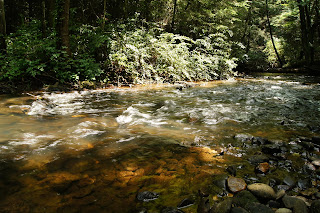
And this is the stream that you walk along near the beginning:

Monday, July 18, 2011

Tallulah Gorge State Park

Tallulah Gorge State Park
338 Jane Hurt Yarn Dr
Tallulah Falls , GA 30573 
http://www.gastateparks.org/TallulahGorge

Park (706) 754-7981
Camping (706) 754-7979


For camping 1 night in a tent, $16 +$3 parking fee. 
Cash or Check; no credit or debit.

$1.50 - bag of ice
$4.00 for bundle of firewood

Camping office is open until 10pm for check-in. After 10pm, cannot leave and re-enter.

The $3 parking fee is good for the whole day you are leaving as well as the night you arrive. 


                   Camping was fairly easy to set up; we had to fill out a form at the front and were given a parking pass (that is also good until midnight the day you leave, so we didn't have to worry about paying $5 to park at the interpretive center) . The camping site on Jane Hurt Yarn Drive is operated by Georgia Power and not the park itself. We arrived around 6:30pm and there were plenty of camping sites available to choose from. There are bathrooms, showers, as well as water pumps at each camping site. The camping sites are also located fairly close together and there is enough room for RVs. Each camping site also has a picnic bench for seating and a fire pit. We were able to find lots of left over firewood from all the empty pits in the camping site. The office also sells bags of ice for $1.50 and bundles of firewood for $4.00. Just be sure you have cash on hand because they don't accept credit cards. 


Park Hours: 8AM-Dark.
Interpretive Center Hours: 8AM-5PM 


Permits:Free permits are required to access the gorge floor and can be obtained at the Interpretive Center. Visitors must wear proper footwear to obtain a permit -- no flip-flops or crocs. Permits will not be issued after 4 p.m. 
Permits limited to 100 per day. On busy days, permits may run out early in the morning. Permits are not transferable.

Groups of 20 can get permits on Saturday and Sunday only. Groups of 30 can get permits Monday through Friday only. To protect the natural resource, no groups larger than 30 are allowed. 

Weather and water flow conditions can restrict gorge floor access.


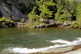
The North Rim Trail (3/4 mile) starts at the Interpretive Center and you can view L’Eau d’Or Falls, Tempesta Falls, Hurricane Falls, and Oceana Falls along the way. If you were able to obtain a gorge permit, you will be doing a lot of rock climbing and jumping. Your shoes might get wet, but the gorge trail is well worth it! Wear a bathing suit because at the end of the Gorge trail, you can go swimming and sliding down a rock into the swimming area, which feels nice on a hot summer day.

To return to the Interpretive Center, you can walk back the way you came or continue onto the Sliding Rock Trail (a new trail that isn't on the hiking maps). WARNING::: Sliding Rock Trail is VERY strenuous!! You will be walking up a very steep incline, and may need to use your hands in some parts to climb. Bring plenty of water with you. Once you reach the top of the Sliding Rock Trail, you will follow the South Rim Trail back to the Interpretive Center. 

The whole hike (roundtrip) should take about 4 hours, longer if you decide to swim for a minute.

Tuesday, July 12, 2011

Amicalola Falls State Park and Lodge


Reservations (800) 864-7275
Lodge Reservations (800) 573-9656
Park (706) 265-4703


A great half day hike, of moderate level. The best trail to take if you want to hike along the creek to the bottom of the falls and then all the way to the top, is the Appalachian Approach Trail (blue blaze). It is the most scenic as well as the longest at 8.5 miles, including 604 stairs.


http://www.gastateparks.org/AmicalolaFalls


The beginning of the Appalachian Approach trail:

Walking along the creek at the bottom of the Appalachian Approach Trail:

View from bridge looking up at Amicalola:

View from bridge looking up at the falls:

View from the top of the falls: